 vesseltracker.com
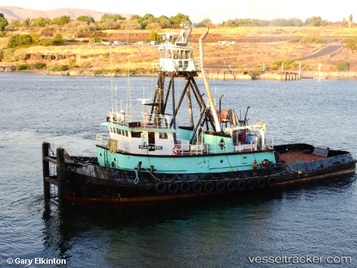
Island Viking
Current StatusWhere is the vessel?
Island Viking is currently in Near Interbay, based on AIS data received about 1h ago.
Latest AIS update:
Current position: 47.57291° N, 122.35638° W (Near Interbay)
Average speed (last 7 days): Loading…
Average speed (last 30 days): Loading…
Vessel profile: Island Viking is a Pusher Tug with dimensions 12m x 35m.
This page combines live AIS, route history, probable destination signals, nearby traffic, and port activity for practical vessel monitoring.
The current position of vessel Island Viking is 47.57291 lat / -122.35638 lng. Updated: 2026-04-19 23:47:38 UTCNearest reference points:
- Near Interbay
- Near Madison Park
- Near Ballard/Seattle
Details:
Live Vessel Island Viking Analytics (details, animations, etc.)
Recent AIS points (UTC):
2026-04-19 19:03:59 UTC · 47.57292, -122.35642 · SOG 0 kn · COG 139°2026-04-19 22:13:38 UTC · 47.57288, -122.35640 · SOG 0 kn · COG 138°
2026-04-19 22:58:18 UTC · 47.57288, -122.35643 · SOG 0 kn · COG 140°
2026-04-19 23:47:38 UTC · 47.57291, -122.35638 · SOG 0 kn · COG 138°