 vesseltracker.com
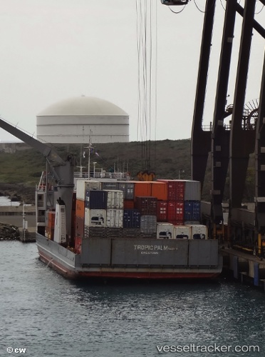
 Tropic Palm
Current Status
Where is the vessel?
Tropic Palm is currently in Near ROAD BAY, based on AIS data received less than 1h ago.
Latest AIS update:
Current position: 18.19821° N, 63.09411° W (Near ROAD BAY)
Average speed (last 7 days): Loading…
Average speed (last 30 days): Loading…
Vessel profile: Tropic Palm is a Ro Ro Cargo Ship with dimensions 97m x 97m.
This page combines live AIS, route history, probable destination signals, nearby traffic, and port activity for practical vessel monitoring.
The current position of vessel Tropic Palm is 18.19821 lat / -63.09411 lng. Updated: 2026-04-13 13:22:04 UTCNearest reference points:
- Near ST MAARTEN
- Near GUSTAVIA
- Near Spanish Town
Currently sailing under the flag of St Vincent Grenadines ![]()
Tropic Palm built in 1978 year
Deadweight:
4810 tDetails:
Live Vessel Tropic Palm Analytics (details, animations, etc.)
Recent AIS points (UTC):
2026-04-13 08:08:17 UTC · 18.09060, -63.43755 · SOG 9.4 kn · COG -1°2026-04-13 09:43:47 UTC · 18.17659, -63.19566 · SOG 8.9 kn · COG -1°
2026-04-13 11:43:03 UTC · 18.19817, -63.09412 · SOG 0 kn · COG -1°
2026-04-13 13:22:04 UTC · 18.19821, -63.09411 · SOG 0.1 kn · COG -1°