 vesseltracker.com
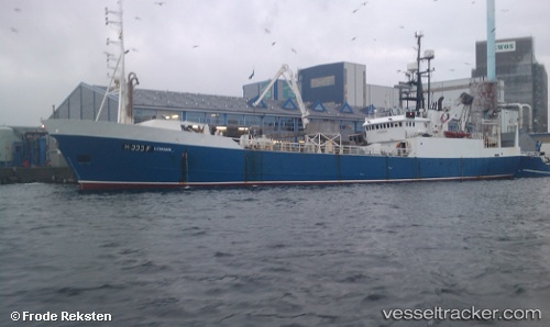
Mayor
Current StatusWhere is the vessel?
Mayor is currently in Near DAKHLA, based on AIS data received less than 1h ago.
Latest AIS update:
Current position: 23.66022° N, 15.94191° W (Near DAKHLA)
Average speed (last 7 days): Loading…
Average speed (last 30 days): Loading…
Vessel profile: Mayor is a Fish Carrier with dimensions 10m x 68m.
This page combines live AIS, route history, probable destination signals, nearby traffic, and port activity for practical vessel monitoring.
The current position of vessel Mayor is 23.66022 lat / -15.94191 lng. Updated: 2026-04-12 16:06:41 UTCNearest reference points:
- Near DAKHLA
- 68 nm NW of Ad Dakhla
- 110 nm NE of Las Brujas
Details:
Live Vessel Mayor Analytics (details, animations, etc.)
Recent AIS points (UTC):
2026-04-12 10:27:21 UTC · 23.66022, -15.94195 · SOG 0.1 kn · COG 222°2026-04-12 11:29:39 UTC · 23.66023, -15.94194 · SOG 0.1 kn · COG 223°
2026-04-12 14:13:23 UTC · 23.66024, -15.94194 · SOG 0 kn · COG 223°
2026-04-12 16:06:41 UTC · 23.66022, -15.94191 · SOG 0.1 kn · COG 222°