 vesseltracker.com
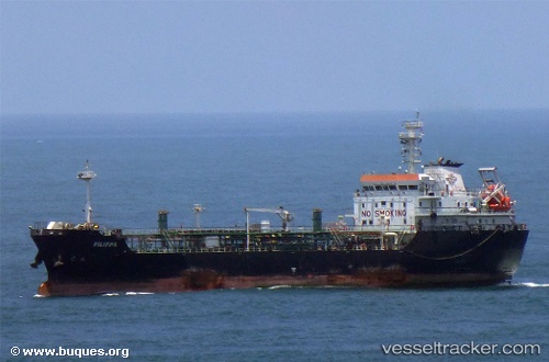
 FILIPPA
Current Status
Where is the vessel?
FILIPPA is currently in Near Punta Cardon, based on AIS data received less than 1h ago.
Latest AIS update:
Current position: 11.62487° N, 70.23341° W (Near Punta Cardon)
Average speed (last 7 days): Loading…
Average speed (last 30 days): Loading…
Vessel profile: FILIPPA is a Tanker with dimensions m x m.
This page combines live AIS, route history, probable destination signals, nearby traffic, and port activity for practical vessel monitoring.
The current position of vessel FILIPPA is 11.62487 lat / -70.23341 lng. Updated: 2026-04-18 12:22:26 UTCNearest reference points:
- Near Las Piedras
- Near Bullenbaai
- 24 nm NW of Palm Beach
Details:
Live Vessel FILIPPA Analytics (details, animations, etc.)
Recent AIS points (UTC):
2026-04-18 06:06:36 UTC · 11.62333, -70.23333 · SOG 0 kn · COG -1°2026-04-18 07:55:16 UTC · 11.62486, -70.23340 · SOG 0 kn · COG 61°
2026-04-18 09:22:22 UTC · 11.62486, -70.23343 · SOG 0 kn · COG 61°
2026-04-18 12:22:26 UTC · 11.62487, -70.23341 · SOG 0 kn · COG 61°