 vesseltracker.com
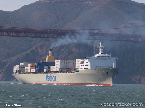
 Manoa
Manoa
Current Status
Where is the vessel?
Manoa is currently in Near Honolulu, based on AIS data received about 1h ago.
Latest AIS update:
Current position: 21.28512° N, 157.91542° W (Near Honolulu)
Average speed (last 7 days): Loading…
Average speed (last 30 days): Loading…
Vessel profile: Manoa is a Container Ship with dimensions 262m x 32m.
This page combines live AIS, route history, probable destination signals, nearby traffic, and port activity for practical vessel monitoring.
The current position of vessel Manoa is 21.28512 lat / -157.91542 lng. Updated: 2026-04-16 23:46:29 UTCNearest reference points:
- Near Honolulu
- Near Kaunakakai
- 132 nm SW of Barbers Point
Currently sailing under the flag of USA ![]()
Details:
Live Vessel Manoa Analytics (details, animations, etc.)
Recent AIS points (UTC):
2026-04-16 15:31:19 UTC · 21.28491, -157.91524 · SOG 0 kn · COG 123°2026-04-16 19:36:34 UTC · 21.28500, -157.91333 · SOG 0 kn · COG -1°
2026-04-16 22:19:23 UTC · 21.28525, -157.91522 · SOG 0 kn · COG 129°
2026-04-16 23:46:29 UTC · 21.28512, -157.91542 · SOG 0.3 kn · COG 152°