 vesseltracker.com
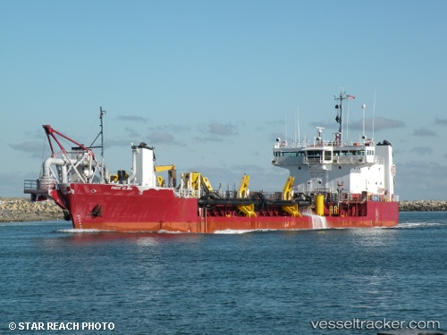
Dodge Island
Current StatusWhere is the vessel?
Dodge Island is currently in Near Sabine Pass, based on AIS data received about 1h ago.
Latest AIS update:
Current position: 29.62010° N, 93.81288° W (Near Sabine Pass)
Average speed (last 7 days): Loading…
Average speed (last 30 days): Loading…
Vessel profile: Dodge Island is a Hopper Dredger with dimensions 16m x 84m.
This page combines live AIS, route history, probable destination signals, nearby traffic, and port activity for practical vessel monitoring.
The current position of vessel Dodge Island is 29.62010 lat / -93.81288 lng. Updated: 2026-04-10 02:39:54 UTCNearest reference points:
- Near SABINE PASS
- 10 nm W of Sabine Pass
- Near Atreco
Details:
Live Vessel Dodge Island Analytics (details, animations, etc.)
Recent AIS points (UTC):
2026-04-09 20:19:03 UTC · 29.62360, -93.81489 · SOG 1.5 kn · COG 132°2026-04-09 22:09:26 UTC · 29.61088, -93.80925 · SOG 0.9 kn · COG 16°
2026-04-10 00:06:24 UTC · 29.62027, -93.81289 · SOG 1.5 kn · COG 1°
2026-04-10 02:39:54 UTC · 29.62010, -93.81288 · SOG 1.3 kn · COG 126°