 vesseltracker.com
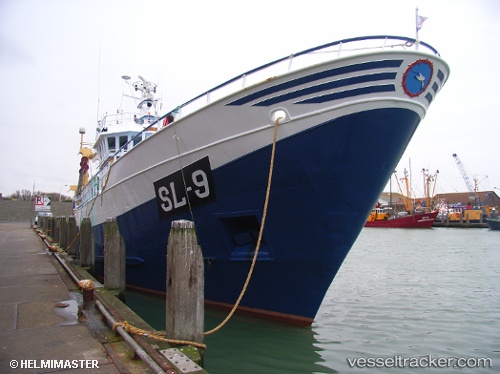
 Sl 9 Johanna
Current Status
Where is the vessel?
Sl 9 Johanna is currently in 20 nm SE of Eastbourne, based on AIS data received less than 1h ago.
Latest AIS update:
Current position: 50.48660° N, 0.58223° E (20 nm SE of Eastbourne)
Average speed (last 7 days): Loading…
Average speed (last 30 days): Loading…
Vessel profile: Sl 9 Johanna is a Fishing Vessel with dimensions 35m x 8m.
This page combines live AIS, route history, probable destination signals, nearby traffic, and port activity for practical vessel monitoring.
The current position of vessel Sl 9 Johanna is 50.48660 lat / 0.58223 lng. Updated: 2026-04-21 20:26:01 UTCNearest reference points:
- 23 nm S of Poling
- Near Saint Leonards-on-Sea
- Near Dungeness
Currently sailing under the flag of Netherlands ![]()
Details:
Live Vessel Sl 9 Johanna Analytics (details, animations, etc.)
Recent AIS points (UTC):
2026-04-21 16:21:50 UTC · 50.50679, 0.63919 · SOG 1.1 kn · COG -1°2026-04-21 17:58:40 UTC · 50.49281, 0.61176 · SOG 1.1 kn · COG -1°
2026-04-21 19:52:01 UTC · 50.48328, 0.56058 · SOG 2.1 kn · COG -1°
2026-04-21 20:26:01 UTC · 50.48660, 0.58223 · SOG 1.6 kn · COG -1°