 vesseltracker.com
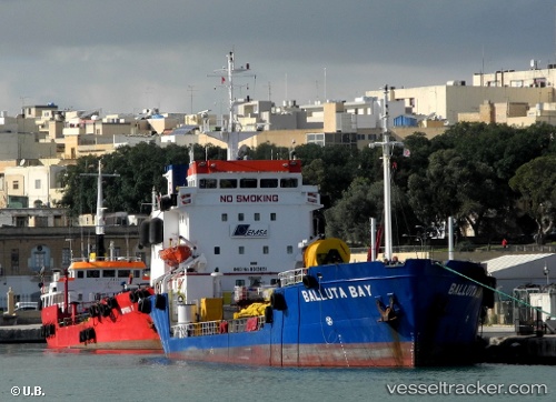
 Balluta Bay
Current Status
Where is the vessel?
Balluta Bay is currently in Near Il-Kappara, based on AIS data received about 2h ago.
Latest AIS update:
Current position: 35.89683° N, 14.74475° E (Near Il-Kappara)
Average speed (last 7 days): Loading…
Average speed (last 30 days): Loading…
Vessel profile: Balluta Bay is a Oil Products Tanker with dimensions 79m x 13m.
This page combines live AIS, route history, probable destination signals, nearby traffic, and port activity for practical vessel monitoring.
The current position of vessel Balluta Bay is 35.89683 lat / 14.74475 lng. Updated: 2026-04-06 01:46:44 UTCNearest reference points:
- 13 nm E of Il-Kappara
- Near Xghajra
- Near Birgu (Vittoriosa)
Currently sailing under the flag of Malta ![]()
Balluta Bay built in 1981 year
Deadweight:
3027 tDetails:
Live Vessel Balluta Bay Analytics (details, animations, etc.)
Recent AIS points (UTC):
2026-04-05 19:37:43 UTC · 35.89688, 14.74464 · SOG 0.1 kn · COG 343°2026-04-05 21:28:49 UTC · 35.89679, 14.74445 · SOG 0.1 kn · COG 347°
2026-04-05 23:55:48 UTC · 35.89677, 14.74435 · SOG 0.2 kn · COG 2°
2026-04-06 01:46:44 UTC · 35.89683, 14.74475 · SOG 0 kn · COG 344°