 vesseltracker.com
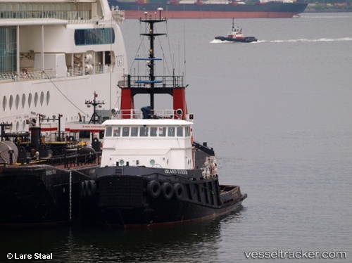
Island Tugger
Current StatusWhere is the vessel?
Island Tugger is currently in Near Prince Rupert, based on AIS data received about 1h ago.
Latest AIS update:
Current position: 54.31288° N, 130.25832° W (Near Prince Rupert)
Average speed (last 7 days): Loading…
Average speed (last 30 days): Loading…
Vessel profile: Island Tugger is a Tug with dimensions 10m x 32m.
This page combines live AIS, route history, probable destination signals, nearby traffic, and port activity for practical vessel monitoring.
The current position of vessel Island Tugger is 54.31288 lat / -130.25832 lng. Updated: 2026-04-13 06:03:51 UTCNearest reference points:
- Near Prince Rupert
- Near Watson Island
- 11 nm S of Kitimat
Details:
Live Vessel Island Tugger Analytics (details, animations, etc.)
Recent AIS points (UTC):
2026-04-12 23:33:46 UTC · 54.31285, -130.25833 · SOG 0 kn · COG 186°2026-04-13 01:33:53 UTC · 54.31283, -130.25833 · SOG 0 kn · COG 186°
2026-04-13 03:29:30 UTC · 54.31167, -130.25667 · SOG 0 kn · COG -1°
2026-04-13 06:03:51 UTC · 54.31288, -130.25832 · SOG 0 kn · COG 186°