 vesseltracker.com
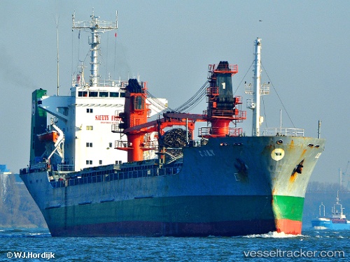
 LILY HA
Current Status
Where is the vessel?
LILY HA is currently in Near Constanta, based on AIS data received about 88d ago.
Latest AIS update:
Current position: 44.12937° N, 28.64960° E (Near Constanta)
Average speed (last 7 days): Loading…
Average speed (last 30 days): Loading…
Vessel profile: LILY HA is a General Cargo Ship with dimensions m x m.
This page combines live AIS, route history, probable destination signals, nearby traffic, and port activity for practical vessel monitoring.
The current position of vessel LILY HA is 44.12937 lat / 28.64960 lng. Updated: 2026-01-21 07:52:07 UTCNearest reference points:
- Near Constanta
- Near Ovidiu
- Near MIDIA
Currently sailing under the flag of Togo ![]()
LILY HA built in 1982 year
Deadweight:
12352 tDetails:
Live Vessel LILY HA Analytics (details, animations, etc.)
Recent AIS points (UTC):
2026-01-21 07:52:07 UTC · 44.12937, 28.64960 · SOG 0 kn · COG -1°