 vesseltracker.com
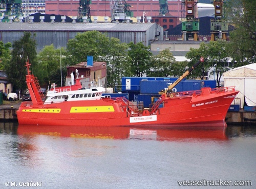
 Glomar Advance
Current Status
Where is the vessel?
Glomar Advance is currently in Near Den Helder, based on AIS data received less than 1h ago.
Latest AIS update:
Current position: 52.94998° N, 4.78698° E (Near Den Helder)
Average speed (last 7 days): Loading…
Average speed (last 30 days): Loading…
Vessel profile: Glomar Advance is a Standby Safety Vessel with dimensions 42m x 9m.
This page combines live AIS, route history, probable destination signals, nearby traffic, and port activity for practical vessel monitoring.
The current position of vessel Glomar Advance is 52.94998 lat / 4.78698 lng. Updated: 2026-04-02 09:55:35 UTCNearest reference points:
- Near Den Helder
- Near TEXEL
- Near OUDESCHILD
Currently sailing under the flag of Panama ![]()
Glomar Advance built in 1983 year
Details:
Live Vessel Glomar Advance Analytics (details, animations, etc.)
Recent AIS points (UTC):
2026-04-02 03:43:36 UTC · 53.05896, 3.59455 · SOG 1.2 kn · COG 171°2026-04-02 05:51:59 UTC · 52.99495, 4.10700 · SOG 10.4 kn · COG 137°
2026-04-02 08:19:29 UTC · 52.95976, 4.71792 · SOG 10.3 kn · COG 44°
2026-04-02 09:55:35 UTC · 52.94998, 4.78698 · SOG 0 kn · COG 308°