 vesseltracker.com
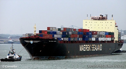
Sealand Atlantic
Current StatusWhere is the vessel?
Sealand Atlantic is currently in 21 nm SW of Ocean Beach, based on AIS data received about 77d ago.
Latest AIS update:
Current position: 32.59878° N, 117.62436° W (21 nm SW of Ocean Beach)
Average speed (last 7 days): Loading…
Average speed (last 30 days): Loading…
Vessel profile: Sealand Atlantic is a Container Ship with dimensions 32m x 290m.
This page combines live AIS, route history, probable destination signals, nearby traffic, and port activity for practical vessel monitoring.
The current position of vessel Sealand Atlantic is 32.59878 lat / -117.62436 lng. Updated: 2026-01-07 23:00:46 UTCNearest reference points:
- 35 nm W of Del Mar, San Diego
- Near Ocean Beach
- Near San Diego
Details:
Live Vessel Sealand Atlantic Analytics (details, animations, etc.)
Recent AIS points (UTC):
2026-01-07 23:00:46 UTC · 32.59878, -117.62436 · SOG 12.7 kn · COG 164°