 vesseltracker.com
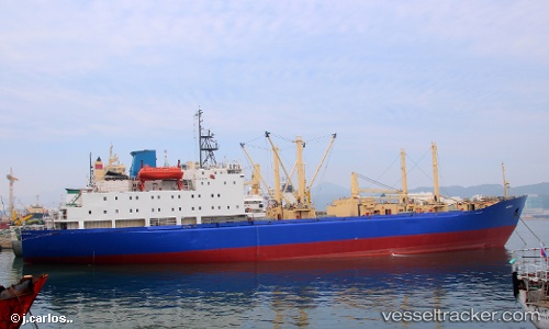
 TAMBOV
Current Status
Where is the vessel?
TAMBOV is currently in Near Dalian, based on AIS data received less than 1h ago.
Latest AIS update:
Current position: 39.01450° N, 121.70043° E (Near Dalian)
Average speed (last 7 days): Loading…
Average speed (last 30 days): Loading…
Vessel profile: TAMBOV is a Fish Carrier with dimensions 153m x 22m.
This page combines live AIS, route history, probable destination signals, nearby traffic, and port activity for practical vessel monitoring.
The current position of vessel TAMBOV is 39.01450 lat / 121.70043 lng. Updated: 2026-04-18 11:50:18 UTCNearest reference points:
- Near Dalian
- 15 nm E of Dalian
- 15 nm SE of Dalian
Currently sailing under the flag of Russia ![]()
TAMBOV built in 1982 year
Deadweight:
12243 tDetails:
Live Vessel TAMBOV Analytics (details, animations, etc.)
Recent AIS points (UTC):
2026-04-18 05:33:38 UTC · 39.01452, 121.70042 · SOG 0 kn · COG 15°2026-04-18 07:52:26 UTC · 39.01454, 121.70041 · SOG 0 kn · COG 15°
2026-04-18 10:23:27 UTC · 39.01454, 121.70043 · SOG 0 kn · COG 15°
2026-04-18 11:50:18 UTC · 39.01450, 121.70043 · SOG 0 kn · COG 15°