 vesseltracker.com
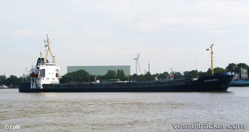
 IBRAHIM B
Current Status
Where is the vessel?
IBRAHIM B is currently in Near Damietta, based on AIS data received less than 1h ago.
Latest AIS update:
Current position: 31.52484° N, 31.73933° E (Near Damietta)
Average speed (last 7 days): Loading…
Average speed (last 30 days): Loading…
Vessel profile: IBRAHIM B is a Cargo with dimensions m x m.
This page combines live AIS, route history, probable destination signals, nearby traffic, and port activity for practical vessel monitoring.
The current position of vessel IBRAHIM B is 31.52484 lat / 31.73933 lng. Updated: 2026-03-30 19:34:59 UTCNearest reference points:
- Near Damietta
- 21 nm N of Port Said
- 15 nm N of Port Said
Currently sailing under the flag of Saint Kitts and Nevis ![]()
Details:
Live Vessel IBRAHIM B Analytics (details, animations, etc.)
Recent AIS points (UTC):
2026-03-30 08:18:56 UTC · 31.52481, 31.73935 · SOG 0 kn · COG -1°2026-03-30 08:18:56 UTC · 31.52481, 31.73935 · SOG 0 kn · COG -1°
2026-03-30 08:18:56 UTC · 31.52481, 31.73935 · SOG 0 kn · COG -1°
2026-03-30 19:34:59 UTC · 31.52484, 31.73933 · SOG 0.1 kn · COG -1°