 vesseltracker.com
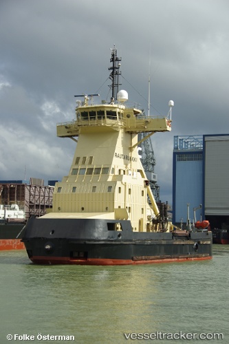
 Rautaruukki
Current Status
Where is the vessel?
Rautaruukki is currently in Near VIRPIPERA, based on AIS data received about 2h ago.
Latest AIS update:
Current position: 64.65676° N, 24.40375° E (Near VIRPIPERA)
Average speed (last 7 days): Loading…
Average speed (last 30 days): Loading…
Vessel profile: Rautaruukki is a Pusher Tug with dimensions 167m x 27m.
This page combines live AIS, route history, probable destination signals, nearby traffic, and port activity for practical vessel monitoring.
The current position of vessel Rautaruukki is 64.65676 lat / 24.40375 lng. Updated: 2026-04-08 05:48:43 UTCNearest reference points:
- Near Karlsborg Axelvik
Currently sailing under the flag of Finland ![]()
Rautaruukki built in 1986 year
Deadweight:
445 tDetails:
Live Vessel Rautaruukki Analytics (details, animations, etc.)
Recent AIS points (UTC):
2026-04-07 23:24:39 UTC · 64.65677, 24.40372 · SOG 0 kn · COG 166°2026-04-08 01:48:41 UTC · 64.65676, 24.40373 · SOG 0.2 kn · COG 166°
2026-04-08 03:25:17 UTC · 64.65676, 24.40374 · SOG 0 kn · COG 166°
2026-04-08 05:48:43 UTC · 64.65676, 24.40375 · SOG 0 kn · COG 166°