 vesseltracker.com
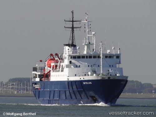
 Ortelius
Current Status
Where is the vessel?
Ortelius is currently in 158 nm SE of LA PALOMA, based on AIS data received less than 1h ago.
Latest AIS update:
Current position: 36.68150° S, 52.08034° W (158 nm SE of LA PALOMA)
Average speed (last 7 days): Loading…
Average speed (last 30 days): Loading…
Vessel profile: Ortelius is a Passenger Ship with dimensions 92m x 18m.
This page combines live AIS, route history, probable destination signals, nearby traffic, and port activity for practical vessel monitoring.
The current position of vessel Ortelius is -36.68150 lat / -52.08034 lng. Updated: 2026-04-03 20:17:08 UTCNearest reference points:
- 75 nm SE of LA PALOMA
- 105 nm SE of Chui
- 55 nm SE of Chui
Currently sailing under the flag of Netherlands ![]()
Ortelius built in 1989 year
Deadweight:
804 tDetails:
Live Vessel Ortelius Analytics (details, animations, etc.)
Recent AIS points (UTC):
2026-04-03 14:23:02 UTC · -37.53213, -52.71381 · SOG 9.5 kn · COG 33°2026-04-03 16:04:48 UTC · -37.28829, -52.53242 · SOG 10 kn · COG 33°
2026-04-03 17:42:58 UTC · -37.05647, -52.35347 · SOG 10.1 kn · COG 27°
2026-04-03 20:17:08 UTC · -36.68150, -52.08034 · SOG 11.1 kn · COG 29°