 vesseltracker.com
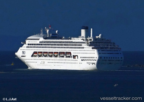
M.v. Karnika
Current StatusWhere is the vessel?
M.v. Karnika is currently in 47 nm SE of Arraial do Cabo, based on AIS data received about 37d ago.
Latest AIS update:
Current position: 23.32196° S, 41.26163° W (47 nm SE of Arraial do Cabo)
Average speed (last 7 days): Loading…
Average speed (last 30 days): Loading…
Vessel profile: M.v. Karnika is a Cruise Ship with dimensions 36m x 246m.
This page combines live AIS, route history, probable destination signals, nearby traffic, and port activity for practical vessel monitoring.
The current position of vessel M.v. Karnika is -23.32196 lat / -41.26163 lng. Updated: 2026-02-18 18:33:16 UTCNearest reference points:
- 47 nm E of Arraial do Cabo
- 24 nm SE of Carapebus
- Near Fluminense FPSO
Details:
Live Vessel M.v. Karnika Analytics (details, animations, etc.)
Recent AIS points (UTC):
2026-02-18 18:33:16 UTC · -23.32196, -41.26163 · SOG 96 kn · COG 39°