 vesseltracker.com
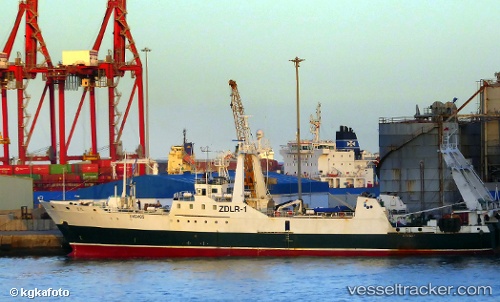
 Sil
Sil
Current Status
Where is the vessel?
Sil is currently in 83 nm SW of Port Stanley, based on AIS data received less than 1h ago.
Latest AIS update:
Current position: 52.89238° S, 58.95592° W (83 nm SW of Port Stanley)
Average speed (last 7 days): Loading…
Average speed (last 30 days): Loading…
Vessel profile: Sil is a Fishing Vessel with dimensions 78m x 78m.
This page combines live AIS, route history, probable destination signals, nearby traffic, and port activity for practical vessel monitoring.
The current position of vessel Sil is -52.89238 lat / -58.95592 lng. Updated: 2026-04-12 21:46:03 UTCCurrently sailing under the flag of UK ![]()
Sil built in 1987 year
Deadweight:
2497 tDetails:
Live Vessel Sil Analytics (details, animations, etc.)
Recent AIS points (UTC):
2026-04-12 15:50:03 UTC · -52.98040, -59.15521 · SOG 4.4 kn · COG 261°2026-04-12 18:18:02 UTC · -52.98553, -59.39220 · SOG 7.6 kn · COG 92°
2026-04-12 20:14:03 UTC · -52.96082, -59.13025 · SOG 5 kn · COG 21°
2026-04-12 21:46:03 UTC · -52.89238, -58.95592 · SOG 4.8 kn · COG 52°