 vesseltracker.com
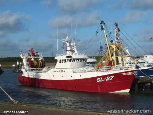
 Sl 27 Johannes
Current Status
Where is the vessel?
Sl 27 Johannes is currently in Near Oostende, based on AIS data received about 1h ago.
Latest AIS update:
Current position: 51.23417° N, 2.93025° E (Near Oostende)
Average speed (last 7 days): Loading…
Average speed (last 30 days): Loading…
Vessel profile: Sl 27 Johannes is a Fishing Vessel with dimensions 36m x 8m.
This page combines live AIS, route history, probable destination signals, nearby traffic, and port activity for practical vessel monitoring.
The current position of vessel Sl 27 Johannes is 51.23417 lat / 2.93025 lng. Updated: 2026-04-21 04:15:44 UTCNearest reference points:
- Near Oostende
- Near Sas-Slijkens
- Near Lombardsijde
Currently sailing under the flag of Netherlands ![]()
Sl 27 Johannes built in 1987 year
Details:
Live Vessel Sl 27 Johannes Analytics (details, animations, etc.)
Recent AIS points (UTC):
2026-04-21 01:43:43 UTC · 51.23421, 2.93033 · SOG 0.5 kn · COG -1°2026-04-21 01:43:53 UTC · 51.23419, 2.93035 · SOG 0.3 kn · COG -1°
2026-04-21 03:34:14 UTC · 51.23421, 2.93033 · SOG 0.2 kn · COG -1°
2026-04-21 04:15:44 UTC · 51.23417, 2.93025 · SOG 0.2 kn · COG -1°