 Artemis Atlantic
Current Status
Where is the vessel?
Artemis Atlantic is currently in Near Avaldsnes, based on AIS data received about 15h ago.
Latest AIS update:
Current position: 59.34267° N, 5.27983° E (Near Avaldsnes)
Average speed (last 7 days): Loading…
Average speed (last 30 days): Loading…
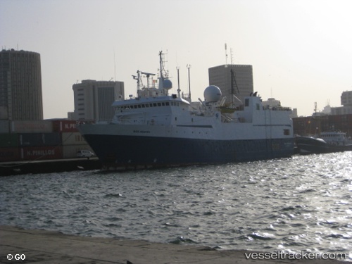
Vessel profile: Artemis Atlantic is a Research Vessel with dimensions 67m x 16m.
This page combines live AIS, route history, probable destination signals, nearby traffic, and port activity for practical vessel monitoring.
The current position of vessel Artemis Atlantic is 59.34267 lat / 5.27983 lng. Updated: 2026-05-24 07:40:29 UTCNearest reference points:
- Near HUSOYA
- Near Storøya
- Near Valevåg
Currently sailing under the flag of Norway ![]()
Artemis Atlantic built in 1986 year
Deadweight:
1145 tDetails:
Live Vessel Artemis Atlantic Analytics (details, animations, etc.)
Recent AIS points (UTC):
2026-05-24 04:22:33 UTC · 59.34267, 5.27983 · SOG 0 kn · COG 272°2026-05-24 05:34:30 UTC · 59.34267, 5.27983 · SOG 0 kn · COG 272°
2026-05-24 07:16:29 UTC · 59.34283, 5.27983 · SOG 0 kn · COG 271°
2026-05-24 07:40:29 UTC · 59.34267, 5.27983 · SOG 0 kn · COG 271°