 vesseltracker.com
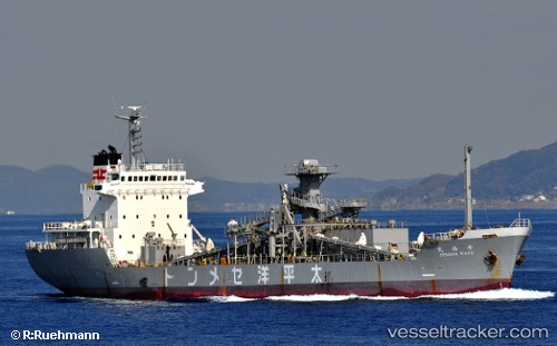
 Sensho
Current Status
Where is the vessel?
Sensho is currently in 336 nm SE of Pizhou, based on AIS data received about 1h ago.
Latest AIS update:
Current position: 14.09167° N, 60.34500° E (336 nm SE of Pizhou)
Average speed (last 7 days): Loading…
Average speed (last 30 days): Loading…
Vessel profile: Sensho is a Cement Carrier with dimensions 114m x 114m.
This page combines live AIS, route history, probable destination signals, nearby traffic, and port activity for practical vessel monitoring.
The current position of vessel Sensho is 14.09167 lat / 60.34500 lng. Updated: 2026-04-15 06:10:26 UTCNearest reference points:
- Open sea, approx. 404 nm off the nearest listed port
- Open sea, approx. 403 nm off the nearest listed port
- Open sea, approx. 407 nm off the nearest listed port
Currently sailing under the flag of Indonesia ![]()
Details:
Live Vessel Sensho Analytics (details, animations, etc.)
Recent AIS points (UTC):
2026-04-14 23:49:19 UTC · 13.64167, 61.15333 · SOG 8 kn · COG -1°2026-04-15 01:19:19 UTC · 13.73667, 60.95667 · SOG 8 kn · COG -1°
2026-04-15 03:25:22 UTC · 13.88167, 60.68667 · SOG 8 kn · COG -1°
2026-04-15 06:10:26 UTC · 14.09167, 60.34500 · SOG 8 kn · COG -1°