 vesseltracker.com
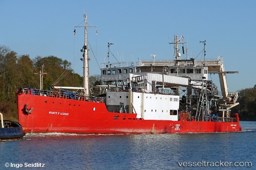
Henry P. Lading
Current StatusWhere is the vessel?
Henry P. Lading is currently in Near Kalundborg, based on AIS data received about 1h ago.
Latest AIS update:
Current position: 55.67490° N, 11.10210° E (Near Kalundborg)
Average speed (last 7 days): Loading…
Average speed (last 30 days): Loading…
Vessel profile: Henry P. Lading is a Cable Layer with dimensions 20m x 90m.
This page combines live AIS, route history, probable destination signals, nearby traffic, and port activity for practical vessel monitoring.
The current position of vessel Henry P. Lading is 55.6749 lat / 11.1021 lng. Updated: 2026-04-08 11:57:54 UTCNearest reference points:
- Near Kalundborg
- Near Eskebjerg
- Near Lindholm Havn
Details:
Live Vessel Henry P. Lading Analytics (details, animations, etc.)
Recent AIS points (UTC):
2026-04-08 05:57:48 UTC · 55.67490, 11.10210 · SOG 0 kn · COG 344°2026-04-08 08:00:49 UTC · 55.67490, 11.10210 · SOG 0 kn · COG 344°
2026-04-08 09:57:50 UTC · 55.67490, 11.10210 · SOG 0 kn · COG 344°
2026-04-08 11:57:54 UTC · 55.67490, 11.10210 · SOG 0 kn · COG 344°