 vesseltracker.com
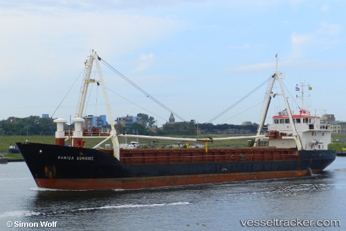
Vessel Danica Sunrise IMO: 8702410, MMSI: 219209000 General Cargo Ship
UTC, 36.23500, 16.21666, course: -1, speed: 9
UTC, 36.14500, 16.58000, course: -1, speed: 9
2026-03-24 15:40:07 UTC, 36.05833, 16.97500, course: -1, speed: 9
Live Vessel Danica Sunrise Analytics (details, animations, etc.)
Live AIS position: UTC. 29 nm NE of Ryuo), updated 2026-03-24 15:40:07 UTC.Find the position of the vessel Danica Sunrise on the map. The latter are known coordinates and path.
marine traffic ship tracker show on live map
The current position of vessel Danica Sunrise is 36.05833 lat / 16.97500 lng. Updated: 2026-03-24 15:40:07 UTCDetails:
Last coordinates of the vessel:
UTC, 36.31931, 15.85042, course: 112, speed: 9.8UTC, 36.23500, 16.21666, course: -1, speed: 9
UTC, 36.14500, 16.58000, course: -1, speed: 9
2026-03-24 15:40:07 UTC, 36.05833, 16.97500, course: -1, speed: 9