 vesseltracker.com
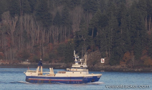
 Northern Alliance
Current Status
Where is the vessel?
Northern Alliance is currently in Near Riverport, based on AIS data received less than 1h ago.
Latest AIS update:
Current position: 44.37621° N, 64.31692° W (Near Riverport)
Average speed (last 7 days): Loading…
Average speed (last 30 days): Loading…
Vessel profile: Northern Alliance is a Fishing Vessel with dimensions 40m x 40m.
This page combines live AIS, route history, probable destination signals, nearby traffic, and port activity for practical vessel monitoring.
The current position of vessel Northern Alliance is 44.37621 lat / -64.31692 lng. Updated: 2026-04-19 08:30:30 UTCNearest reference points:
- Near Liverpool
- Near Halifax
- Near Eastern Passage
Currently sailing under the flag of Canada ![]()
Northern Alliance built in 1990 year
Deadweight:
229 tDetails:
Live Vessel Northern Alliance Analytics (details, animations, etc.)
Recent AIS points (UTC):
2026-04-19 01:35:19 UTC · 44.37622, -64.31695 · SOG 0.1 kn · COG -1°2026-04-19 03:48:59 UTC · 44.37627, -64.31695 · SOG 0 kn · COG -1°
2026-04-19 05:34:30 UTC · 44.37621, -64.31694 · SOG 0 kn · COG -1°
2026-04-19 08:30:30 UTC · 44.37621, -64.31692 · SOG 0 kn · COG -1°