 vesseltracker.com
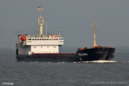
Vessel Volaris 53 IMO: 8720230, MMSI: 341447000 General Cargo Ship
UTC, 47.20371, 38.95240, course: 306, speed: 1.5
UTC, 47.20371, 38.95240, course: 306, speed: 1.5
2026-03-24 09:32:19 UTC, 47.20371, 38.95240, course: 306, speed: 1.5
Live Vessel Volaris 53 Analytics (details, animations, etc.)
Live AIS position: UTC. Near Taganrog), updated 2026-03-24 09:32:19 UTC.Find the position of the vessel Volaris 53 on the map. The latter are known coordinates and path.
marine traffic ship tracker show on live map
The current position of vessel Volaris 53 is 47.20371 lat / 38.95240 lng. Updated: 2026-03-24 09:32:19 UTCDetails:
Last coordinates of the vessel:
UTC, 47.20333, 38.95167, course: -1, speed: 0UTC, 47.20371, 38.95240, course: 306, speed: 1.5
UTC, 47.20371, 38.95240, course: 306, speed: 1.5
2026-03-24 09:32:19 UTC, 47.20371, 38.95240, course: 306, speed: 1.5