 vesseltracker.com
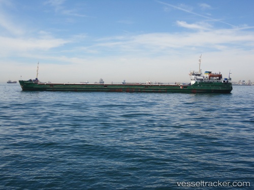
 Selim
Selim
Current Status
Where is the vessel?
Selim is currently in 94 nm NW of Hongdo, based on AIS data received about 1d ago.
Latest AIS update:
Current position: 35.85500° N, 123.95667° E (94 nm NW of Hongdo)
Average speed (last 7 days): Loading…
Average speed (last 30 days): Loading…
Vessel profile: Selim is a General Cargo Ship with dimensions 114m x 114m.
This page combines live AIS, route history, probable destination signals, nearby traffic, and port activity for practical vessel monitoring.
The current position of vessel Selim is 35.85500 lat / 123.95667 lng. Updated: 2026-04-05 07:35:01 UTCNearest reference points:
- 93 nm SE of SHIDAO
- 78 nm SE of Shidao Pt
- 81 nm SE of SHIDAO
Currently sailing under the flag of Tanzania ![]()
Selim built in 1979 year
Deadweight:
2893 tDetails:
Live Vessel Selim Analytics (details, animations, etc.)
Recent AIS points (UTC):
2026-04-05 03:30:55 UTC · 35.24961, 124.02758 · SOG 8.6 kn · COG 345°2026-04-05 03:30:55 UTC · 35.24961, 124.02758 · SOG 8.6 kn · COG 345°
2026-04-05 06:14:07 UTC · 35.65333, 123.99500 · SOG 9 kn · COG -1°
2026-04-05 07:35:01 UTC · 35.85500, 123.95667 · SOG 9 kn · COG -1°