 vesseltracker.com
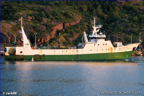
Cidade De Amarante
Current StatusWhere is the vessel?
Cidade De Amarante is currently in 100 nm E of White Rose Field, based on AIS data received about 12h ago.
Latest AIS update:
Current position: 46.44596° N, 45.63635° W (100 nm E of White Rose Field)
Average speed (last 7 days): Loading…
Average speed (last 30 days): Loading…
Vessel profile: Cidade De Amarante is a Fishing Vessel with dimensions 12m x 65m.
This page combines live AIS, route history, probable destination signals, nearby traffic, and port activity for practical vessel monitoring.
The current position of vessel Cidade De Amarante is 46.44596 lat / -45.63635 lng. Updated: 2026-04-04 11:48:20 UTCNearest reference points:
- 165 nm S of White Rose Field
Details:
Live Vessel Cidade De Amarante Analytics (details, animations, etc.)
Recent AIS points (UTC):
2026-04-04 11:33:49 UTC · 46.45556, -45.61717 · SOG 5.6 kn · COG -1°2026-04-04 11:48:20 UTC · 46.44596, -45.63635 · SOG 3.7 kn · COG -1°
2026-04-04 11:48:20 UTC · 46.44596, -45.63635 · SOG 3.7 kn · COG -1°
2026-04-04 11:48:20 UTC · 46.44596, -45.63635 · SOG 3.7 kn · COG -1°