 vesseltracker.com
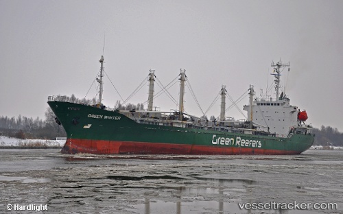
Tai Ji
Current StatusWhere is the vessel?
Tai Ji is currently in Near Chattogram, based on AIS data received about 13d ago.
Latest AIS update:
Current position: 22.46093° N, 91.71967° E (Near Chattogram)
Average speed (last 7 days): Loading…
Average speed (last 30 days): Loading…
Vessel profile: Tai Ji is a Refrigerated Cargo Ship with dimensions 18m x 124m.
This page combines live AIS, route history, probable destination signals, nearby traffic, and port activity for practical vessel monitoring.
The current position of vessel Tai Ji is 22.46093 lat / 91.71967 lng. Updated: 2026-04-06 09:12:21 UTCNearest reference points:
- 12 nm NW of Chattogram
- Near Chittagong
- 23 nm NW of Cox's Bazar
Details:
Live Vessel Tai Ji Analytics (details, animations, etc.)
Recent AIS points (UTC):
2026-04-06 07:24:18 UTC · 22.37988, 91.69992 · SOG 12.6 kn · COG 13°2026-04-06 09:12:21 UTC · 22.46093, 91.71967 · SOG 0 kn · COG 63°
2026-04-06 09:12:21 UTC · 22.46093, 91.71967 · SOG 0 kn · COG 63°
2026-04-06 09:12:21 UTC · 22.46093, 91.71967 · SOG 0 kn · COG 63°