 vesseltracker.com
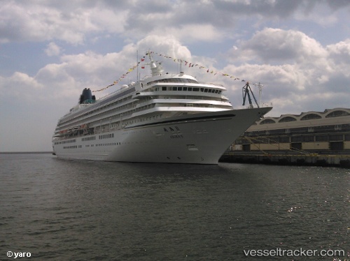
 Asuka 2
Current Status
Where is the vessel?
Asuka 2 is currently in Near Yamashitacho, based on AIS data received about 1h ago.
Latest AIS update:
Current position: 35.44025° N, 139.70085° E (Near Yamashitacho)
Average speed (last 7 days): Loading…
Average speed (last 30 days): Loading…
Vessel profile: Asuka 2 is a Cruise Ship with dimensions 241m x 30m.
This page combines live AIS, route history, probable destination signals, nearby traffic, and port activity for practical vessel monitoring.
The current position of vessel Asuka 2 is 35.44025 lat / 139.70085 lng. Updated: 2026-04-20 22:39:43 UTCNearest reference points:
- Near Yokohama
- Near Kawasaki
- Near Naka-Ku, Kanagawa
Currently sailing under the flag of Japan ![]()
Asuka 2 built in 1990 year
Deadweight:
8642 tDetails:
Live Vessel Asuka 2 Analytics (details, animations, etc.)
Recent AIS points (UTC):
2026-04-20 19:27:10 UTC · 34.93243, 139.48216 · SOG 15.2 kn · COG 59°2026-04-20 20:07:41 UTC · 35.01949, 139.63669 · SOG 12.4 kn · COG 53°
2026-04-20 21:36:22 UTC · 35.26182, 139.77747 · SOG 13.2 kn · COG 326°
2026-04-20 22:39:43 UTC · 35.44025, 139.70085 · SOG 7.4 kn · COG 302°