 vesseltracker.com
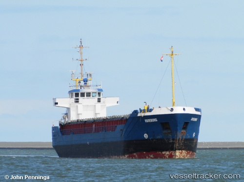
 Roseburg
Current Status
Where is the vessel?
Roseburg is currently in Near PALJASSAARE , based on AIS data received less than 1h ago.
Latest AIS update:
Current position: 59.45721° N, 24.70329° E (Near PALJASSAARE )
Average speed (last 7 days): Loading…
Average speed (last 30 days): Loading…
Vessel profile: Roseburg is a General Cargo Ship with dimensions 82m x 12m.
This page combines live AIS, route history, probable destination signals, nearby traffic, and port activity for practical vessel monitoring.
The current position of vessel Roseburg is 59.45721 lat / 24.70329 lng. Updated: 2026-04-05 11:58:25 UTCNearest reference points:
- Near Vanasadam
- Near Aegna
- Near Nurme
Currently sailing under the flag of Antigua Barbuda ![]()
Roseburg built in 1991 year
Deadweight:
3005 tDetails:
Live Vessel Roseburg Analytics (details, animations, etc.)
Recent AIS points (UTC):
2026-04-05 06:04:20 UTC · 59.45722, 24.70327 · SOG 0 kn · COG 203°2026-04-05 08:10:23 UTC · 59.45720, 24.70328 · SOG 0 kn · COG 203°
2026-04-05 10:16:24 UTC · 59.45722, 24.70327 · SOG 0 kn · COG 203°
2026-04-05 11:58:25 UTC · 59.45721, 24.70329 · SOG 0 kn · COG 203°