 vesseltracker.com
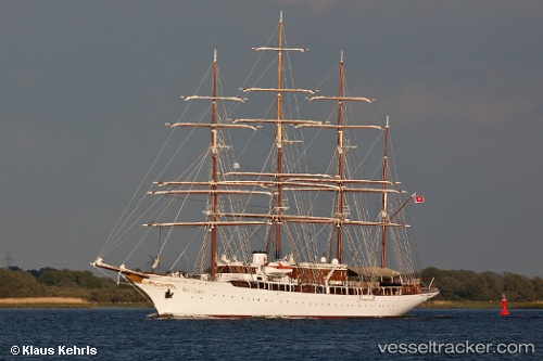
 Sea Cloud
Current Status
Where is the vessel?
Sea Cloud is currently in Near Birgu (Vittoriosa), based on AIS data received about 87d ago.
Latest AIS update:
Current position: 35.88566° N, 14.51600° E (Near Birgu (Vittoriosa))
Average speed (last 7 days): Loading…
Average speed (last 30 days): Loading…
Vessel profile: Sea Cloud is a Cruise Ship with dimensions 110m x 15m.
This page combines live AIS, route history, probable destination signals, nearby traffic, and port activity for practical vessel monitoring.
The current position of vessel Sea Cloud is 35.88566 lat / 14.51600 lng. Updated: 2026-01-21 14:10:38 UTCNearest reference points:
- Near Birgu (Vittoriosa)
- Near Valletta
- Near Sliema
Currently sailing under the flag of Malta ![]()
Sea Cloud built in 1931 year
Deadweight:
788 tDetails:
Live Vessel Sea Cloud Analytics (details, animations, etc.)
Recent AIS points (UTC):
2026-01-21 14:10:38 UTC · 35.88566, 14.51600 · SOG 0 kn · COG 158°