 vesseltracker.com
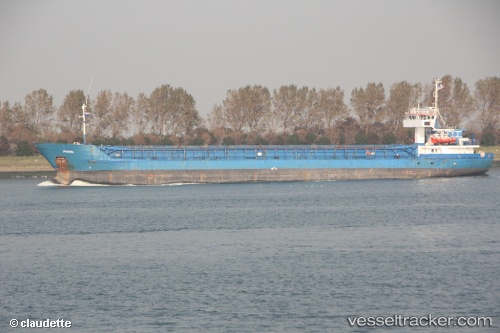
 ROJA
ROJA
Current Status
Where is the vessel?
ROJA is currently in 68 nm W of Krasnovodsk, based on AIS data received about 10d ago.
Latest AIS update:
Current position: 40.34427° N, 51.54454° E (68 nm W of Krasnovodsk)
Average speed (last 7 days): Loading…
Average speed (last 30 days): Loading…
Vessel profile: ROJA is a General Cargo Ship with dimensions 108m x 15m.
This page combines live AIS, route history, probable destination signals, nearby traffic, and port activity for practical vessel monitoring.
The current position of vessel ROJA is 40.34427 lat / 51.54454 lng. Updated: 2026-03-31 14:33:38 UTCNearest reference points:
- 27 nm SE of Heydar Aliyev International Apt.
- 42 nm W of Hazar
- 12 nm E of Heydar Aliyev International Apt.
Currently sailing under the flag of Iran ![]()
ROJA built in 1984 year
Deadweight:
3230 tDetails:
Live Vessel ROJA Analytics (details, animations, etc.)
Recent AIS points (UTC):
2026-03-31 13:52:07 UTC · 40.30577, 51.63885 · SOG 7.1 kn · COG 297°2026-03-31 14:33:38 UTC · 40.34427, 51.54454 · SOG 7 kn · COG 298°
2026-03-31 14:33:38 UTC · 40.34427, 51.54454 · SOG 7 kn · COG 298°
2026-03-31 14:33:38 UTC · 40.34427, 51.54454 · SOG 7 kn · COG 298°