 vesseltracker.com
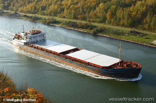
Oneriva 42
Current StatusWhere is the vessel?
Oneriva 42 is currently in Near Ikryanoye, based on AIS data received about 1h ago.
Latest AIS update:
Current position: 46.05420° N, 47.67322° E (Near Ikryanoye)
Average speed (last 7 days): Loading…
Average speed (last 30 days): Loading…
Vessel profile: Oneriva 42 is a General Cargo Ship with dimensions 16m x 105m.
This page combines live AIS, route history, probable destination signals, nearby traffic, and port activity for practical vessel monitoring.
The current position of vessel Oneriva 42 is 46.05420 lat / 47.67322 lng. Updated: 2026-04-13 17:12:50 UTCNearest reference points:
- 12 nm NW of Trudfront
- Near Krasnyye Barrikady
- Near Astrakhan
Details:
Live Vessel Oneriva 42 Analytics (details, animations, etc.)
Recent AIS points (UTC):
2026-04-13 11:03:49 UTC · 46.34219, 47.96482 · SOG 7.5 kn · COG 355°2026-04-13 11:03:49 UTC · 46.34219, 47.96482 · SOG 7.5 kn · COG 355°
2026-04-13 11:03:49 UTC · 46.34219, 47.96482 · SOG 7.5 kn · COG 355°
2026-04-13 17:12:50 UTC · 46.05420, 47.67322 · SOG 4.7 kn · COG 355°