 vesseltracker.com
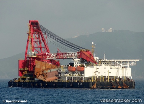
Nan Tian Long
Current StatusWhere is the vessel?
Nan Tian Long is currently in 30 nm NW of Pei-Hai, based on AIS data received about 1h ago.
Latest AIS update:
Current position: 20.81333° N, 108.62333° E (30 nm NW of Pei-Hai)
Average speed (last 7 days): Loading…
Average speed (last 30 days): Loading…
Vessel profile: Nan Tian Long is a Salvage Ship with dimensions 30m x 100m.
This page combines live AIS, route history, probable destination signals, nearby traffic, and port activity for practical vessel monitoring.
The current position of vessel Nan Tian Long is 20.81333 lat / 108.62333 lng. Updated: 2026-03-29 09:01:45 UTCNearest reference points:
- 36 nm NW of Pei-Hai
- 26 nm SE of Qisha Pt
- Near Haikou New Pt
Details:
Live Vessel Nan Tian Long Analytics (details, animations, etc.)
Recent AIS points (UTC):
2026-03-29 03:22:37 UTC · 20.81333, 108.62333 · SOG 0 kn · COG -1°2026-03-29 05:43:39 UTC · 20.81333, 108.62333 · SOG 0 kn · COG -1°
2026-03-29 07:22:47 UTC · 20.81333, 108.62333 · SOG 0 kn · COG -1°
2026-03-29 09:01:45 UTC · 20.81333, 108.62333 · SOG 0 kn · COG -1°