 vesseltracker.com
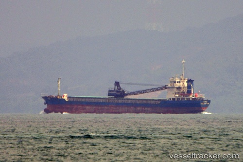
 Mv.hanei
Current Status
Where is the vessel?
Mv.hanei is currently in Near PONTIANAK, based on AIS data received about 1h ago.
Latest AIS update:
Current position: 0.00665° S, 109.32892° E (Near PONTIANAK)
Average speed (last 7 days): Loading…
Average speed (last 30 days): Loading…
Vessel profile: Mv.hanei is a General Cargo Ship with dimensions 90m x 14m.
This page combines live AIS, route history, probable destination signals, nearby traffic, and port activity for practical vessel monitoring.
The current position of vessel Mv.hanei is -0.00665 lat / 109.32892 lng. Updated: 2026-04-20 02:04:56 UTCNearest reference points:
- 12 nm SE of PONTIANAK
- 17 nm SW of Sanggau
- 81 nm N of Belitung
Currently sailing under the flag of Indonesia ![]()
Details:
Live Vessel Mv.hanei Analytics (details, animations, etc.)
Recent AIS points (UTC):
2026-04-19 22:56:03 UTC · -0.00665, 109.32894 · SOG 0 kn · COG -1°2026-04-19 23:58:44 UTC · -0.00663, 109.32894 · SOG 0 kn · COG -1°
2026-04-20 02:03:46 UTC · -0.00664, 109.32893 · SOG 0 kn · COG -1°
2026-04-20 02:04:56 UTC · -0.00665, 109.32892 · SOG 0 kn · COG -1°