 vesseltracker.com
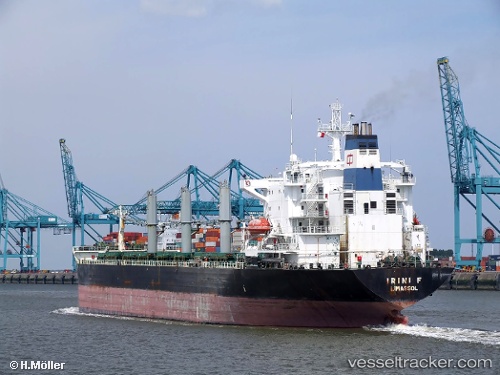
 Petra I
Current Status
Where is the vessel?
Petra I is currently in 13 nm NW of Conakry, based on AIS data received less than 1h ago.
Latest AIS update:
Current position: 9.60042° N, 13.92607° W (13 nm NW of Conakry)
Average speed (last 7 days): Loading…
Average speed (last 30 days): Loading…
Vessel profile: Petra I is a Bulk Carrier with dimensions 183m x 31m.
This page combines live AIS, route history, probable destination signals, nearby traffic, and port activity for practical vessel monitoring.
The current position of vessel Petra I is 9.60042 lat / -13.92607 lng. Updated: 2026-04-14 16:01:03 UTCNearest reference points:
- Near Conakry
- 28 nm S of Conakry
- 49 nm S of Port de Boké
Currently sailing under the flag of Panama ![]()
Petra I built in 1991 year
Deadweight:
42263 tDetails:
Live Vessel Petra I Analytics (details, animations, etc.)
Recent AIS points (UTC):
2026-04-14 09:34:02 UTC · 9.59511, -13.92767 · SOG 0 kn · COG 24°2026-04-14 12:13:03 UTC · 9.59588, -13.92790 · SOG 0 kn · COG 43°
2026-04-14 13:49:05 UTC · 9.60048, -13.92712 · SOG 0 kn · COG 184°
2026-04-14 16:01:03 UTC · 9.60042, -13.92607 · SOG 0 kn · COG 205°