 vesseltracker.com
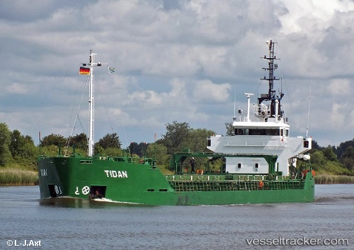
 YAM 1
YAM 1
Current Status
Where is the vessel?
YAM 1 is currently in 55 nm NW of En Nâqoûra, based on AIS data received about 2h ago.
Latest AIS update:
Current position: 33.62667° N, 34.21620° E (55 nm NW of En Nâqoûra)
Average speed (last 7 days): Loading…
Average speed (last 30 days): Loading…
Vessel profile: YAM 1 is a General Cargo with dimensions m x m.
This page combines live AIS, route history, probable destination signals, nearby traffic, and port activity for practical vessel monitoring.
The current position of vessel YAM 1 is 33.62667 lat / 34.21620 lng. Updated: 2026-04-19 14:56:57 UTCNearest reference points:
- 22 nm W of Haifa Granaries
- 31 nm SE of Vasilikos
- Near Haifa
Currently sailing under the flag of Saint Kitts and Nevis ![]()
Details:
Live Vessel YAM 1 Analytics (details, animations, etc.)
Recent AIS points (UTC):
2026-04-19 13:37:53 UTC · 33.76363, 34.09023 · SOG 8.2 kn · COG 149°2026-04-19 14:20:29 UTC · 33.68833, 34.15667 · SOG 7 kn · COG -1°
2026-04-19 14:56:57 UTC · 33.62667, 34.21620 · SOG 5.7 kn · COG 146°
2026-04-19 14:56:57 UTC · 33.62667, 34.21620 · SOG 5.7 kn · COG 146°