 vesseltracker.com
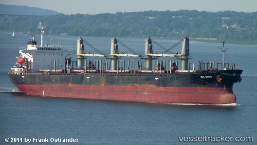
 ASA NADIYA
Current Status
Where is the vessel?
ASA NADIYA is currently in Near Mamonal, based on AIS data received about 1h ago.
Latest AIS update:
Current position: 10.31402° N, 75.51903° W (Near Mamonal)
Average speed (last 7 days): Loading…
Average speed (last 30 days): Loading…
Vessel profile: ASA NADIYA is a Bulk Carrier with dimensions 31m x 180m.
This page combines live AIS, route history, probable destination signals, nearby traffic, and port activity for practical vessel monitoring.
The current position of vessel ASA NADIYA is 10.31402 lat / -75.51903 lng. Updated: 2026-04-18 09:24:11 UTCNearest reference points:
- Near Contecar
- Near Sociedad Portuaria Regional Cartagena
- Near Santa Marta
Currently sailing under the flag of Tanzania ![]()
ASA NADIYA built in 1990 year
Deadweight:
42025 tDetails:
Live Vessel ASA NADIYA Analytics (details, animations, etc.)
Recent AIS points (UTC):
2026-04-18 03:55:22 UTC · 10.31396, -75.51922 · SOG 0.1 kn · COG -1°2026-04-18 06:19:11 UTC · 10.31400, -75.51934 · SOG 0 kn · COG -1°
2026-04-18 07:59:32 UTC · 10.31406, -75.51943 · SOG 0 kn · COG -1°
2026-04-18 09:24:11 UTC · 10.31402, -75.51903 · SOG 0 kn · COG 173°