 vesseltracker.com
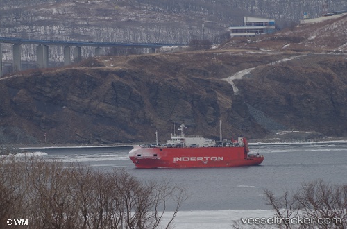
 NEKSU
NEKSU
Current Status
Where is the vessel?
NEKSU is currently in 154 nm NW of Nanao, based on AIS data received about 9h ago.
Latest AIS update:
Current position: 39.37325° N, 135.55164° E (154 nm NW of Nanao)
Average speed (last 7 days): Loading…
Average speed (last 30 days): Loading…
Vessel profile: NEKSU is a Vehicles Carrier with dimensions 66m x 12m.
This page combines live AIS, route history, probable destination signals, nearby traffic, and port activity for practical vessel monitoring.
The current position of vessel NEKSU is 39.37325 lat / 135.55164 lng. Updated: 2026-04-12 21:03:37 UTCNearest reference points:
- 63 nm NW of Sado Shima Apt
- 82 nm NE of Dokdo
Currently sailing under the flag of Togo ![]()
NEKSU built in 1989 year
Deadweight:
0 tDetails:
Live Vessel NEKSU Analytics (details, animations, etc.)
Recent AIS points (UTC):
2026-04-12 19:06:35 UTC · 39.14474, 135.77180 · SOG 9.3 kn · COG -1°2026-04-12 21:03:37 UTC · 39.37325, 135.55164 · SOG 8.6 kn · COG 318°
2026-04-12 21:03:37 UTC · 39.37325, 135.55164 · SOG 8.6 kn · COG 318°
2026-04-12 21:03:37 UTC · 39.37325, 135.55164 · SOG 8.6 kn · COG 318°