 vesseltracker.com
 Tranoy
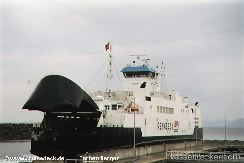
Current Status
Where is the vessel?
Tranoy is currently in Near SVOLVAER, based on AIS data received about 1h ago.
Latest AIS update:
Current position: 68.23431° N, 14.55148° E (Near SVOLVAER)
Average speed (last 7 days): Loading…
Average speed (last 30 days): Loading…
Vessel profile: Tranoy is a Passenger Ro Ro Cargo Ship with dimensions 92m x 15m.
This page combines live AIS, route history, probable destination signals, nearby traffic, and port activity for practical vessel monitoring.
The current position of vessel Tranoy is 68.23431 lat / 14.55148 lng. Updated: 2026-04-15 03:28:36 UTCNearest reference points:
- Near SVOLVAER
- Near Berrvik (Bergvik)
- Near Eidet
Currently sailing under the flag of Norway ![]()
Tranoy built in 1990 year
Deadweight:
788 tDetails:
Live Vessel Tranoy Analytics (details, animations, etc.)
Recent AIS points (UTC):
2026-04-14 20:16:59 UTC · 68.17780, 14.59754 · SOG 13.6 kn · COG 335°2026-04-14 21:34:37 UTC · 68.23431, 14.55160 · SOG 0 kn · COG 201°
2026-04-14 23:34:34 UTC · 68.23426, 14.55154 · SOG 0 kn · COG 201°
2026-04-15 03:28:36 UTC · 68.23431, 14.55148 · SOG 0 kn · COG 202°