 vesseltracker.com
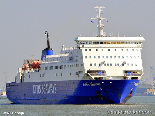
 Patria Seaways
Current Status
Where is the vessel?
Patria Seaways is currently in Near Frederikshavn, based on AIS data received less than 1h ago.
Latest AIS update:
Current position: 57.43369° N, 10.54415° E (Near Frederikshavn)
Average speed (last 7 days): Loading…
Average speed (last 30 days): Loading…
Vessel profile: Patria Seaways is a Passenger Ro Ro Cargo Ship with dimensions 154m x 24m.
This page combines live AIS, route history, probable destination signals, nearby traffic, and port activity for practical vessel monitoring.
The current position of vessel Patria Seaways is 57.43369 lat / 10.54415 lng. Updated: 2026-03-30 03:43:34 UTCNearest reference points:
- Near Frederikshavn
- Near SKAGEN
- Near Hirtshals
Currently sailing under the flag of Lithuania ![]()
Patria Seaways built in 1991 year
Deadweight:
4758 tDetails:
Live Vessel Patria Seaways Analytics (details, animations, etc.)
Recent AIS points (UTC):
2026-03-29 21:37:32 UTC · 57.43369, 10.54415 · SOG 0 kn · COG 251°2026-03-29 23:49:32 UTC · 57.43372, 10.54412 · SOG 0 kn · COG 251°
2026-03-30 01:40:52 UTC · 57.43370, 10.54416 · SOG 0 kn · COG 251°
2026-03-30 03:43:34 UTC · 57.43369, 10.54415 · SOG 0 kn · COG 251°