 vesseltracker.com
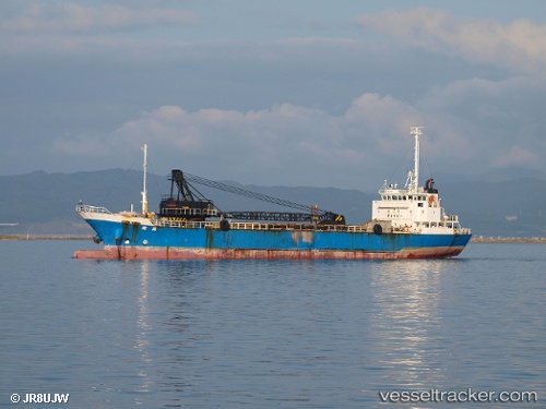
 ILDA
ILDA
Current Status
Where is the vessel?
ILDA is currently in Near RAJAEI, based on AIS data received less than 1h ago.
Latest AIS update:
Current position: 27.10071° N, 56.14331° E (Near RAJAEI)
Average speed (last 7 days): Loading…
Average speed (last 30 days): Loading…
Vessel profile: ILDA is a Cargo with dimensions m x m.
This page combines live AIS, route history, probable destination signals, nearby traffic, and port activity for practical vessel monitoring.
The current position of vessel ILDA is 27.10071 lat / 56.14331 lng. Updated: 2026-04-16 15:48:32 UTCNearest reference points:
- Near RAJAEI
- Near SHAHID BAHONAR
- Near QUESHM
Currently sailing under the flag of Comoros ![]()
Details:
Live Vessel ILDA Analytics (details, animations, etc.)
Recent AIS points (UTC):
2026-04-16 01:18:56 UTC · 27.10448, 56.06973 · SOG 0 kn · COG -1°2026-04-16 02:21:57 UTC · 27.10449, 56.06972 · SOG 0 kn · COG -1°
2026-04-16 13:20:52 UTC · 27.10093, 56.14344 · SOG 0 kn · COG -1°
2026-04-16 15:48:32 UTC · 27.10071, 56.14331 · SOG 0 kn · COG -1°