 vesseltracker.com
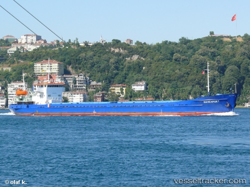
Vessel Omskiy 86 IMO: 8936798, MMSI: 273337010 Multi Purpose Carrier
UTC, 38.62768, 52.73596, course: 179, speed: 6.6
UTC, 38.62768, 52.73596, course: 179, speed: 6.6
2026-03-20 12:35:57 UTC, 38.62768, 52.73596, course: 179, speed: 6.6
Live Vessel Omskiy 86 Analytics (details, animations, etc.)
Live AIS position: UTC. 50 nm S of Cheleken), updated 2026-03-20 12:35:57 UTC.Find the position of the vessel Omskiy 86 on the map. The latter are known coordinates and path.
marine traffic ship tracker show on live map
The current position of vessel Omskiy 86 is 38.62768 lat / 52.73596 lng. Updated: 2026-03-20 12:35:57 UTCDetails:
Last coordinates of the vessel:
UTC, 38.71825, 52.72753, course: 177, speed: 6.3UTC, 38.62768, 52.73596, course: 179, speed: 6.6
UTC, 38.62768, 52.73596, course: 179, speed: 6.6
2026-03-20 12:35:57 UTC, 38.62768, 52.73596, course: 179, speed: 6.6