 vesseltracker.com
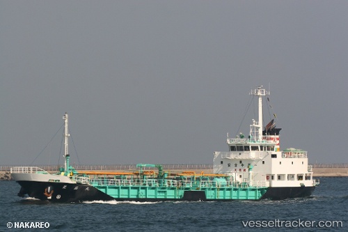
 Ryosei Maru
Current Status
Where is the vessel?
Ryosei Maru is currently in 14 nm SE of Izu, based on AIS data received less than 1h ago.
Latest AIS update:
Current position: 34.83165° N, 139.15428° E (14 nm SE of Izu)
Average speed (last 7 days): Loading…
Average speed (last 30 days): Loading…
Vessel profile: Ryosei Maru is a Bitumen Tanker with dimensions 71m x 11m.
This page combines live AIS, route history, probable destination signals, nearby traffic, and port activity for practical vessel monitoring.
The current position of vessel Ryosei Maru is 34.83165 lat / 139.15428 lng. Updated: 2026-04-08 03:27:51 UTCNearest reference points:
- Near Iruma
- Near Toshima/Tokyo
- 10 nm SE of Iruma
Currently sailing under the flag of Japan ![]()
Details:
Live Vessel Ryosei Maru Analytics (details, animations, etc.)
Recent AIS points (UTC):
2026-04-07 21:50:23 UTC · 35.37667, 139.72667 · SOG 0 kn · COG -1°2026-04-07 23:51:52 UTC · 35.22605, 139.77231 · SOG 12.6 kn · COG 178°
2026-04-08 01:27:52 UTC · 35.03358, 139.49236 · SOG 10.7 kn · COG 242°
2026-04-08 03:27:51 UTC · 34.83165, 139.15428 · SOG 10.6 kn · COG 215°