 vesseltracker.com
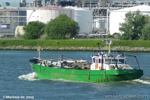
 Bru 14 Luctor Et
Current Status
Where is the vessel?
Bru 14 Luctor Et is currently in Near OUDESCHILD, based on AIS data received less than 1h ago.
Latest AIS update:
Current position: 52.99580° N, 4.87864° E (Near OUDESCHILD)
Average speed (last 7 days): Loading…
Average speed (last 30 days): Loading…
Vessel profile: Bru 14 Luctor Et is a Fishing Vessel with dimensions 36m x 7m.
This page combines live AIS, route history, probable destination signals, nearby traffic, and port activity for practical vessel monitoring.
The current position of vessel Bru 14 Luctor Et is 52.99580 lat / 4.87864 lng. Updated: 2026-03-31 07:27:01 UTCNearest reference points:
- Near OUDESCHILD
- Near TEXEL
- Near Den Helder
Currently sailing under the flag of Netherlands ![]()
Details:
Live Vessel Bru 14 Luctor Et Analytics (details, animations, etc.)
Recent AIS points (UTC):
2026-03-31 02:00:52 UTC · 52.92214, 5.04025 · SOG 0 kn · COG 63°2026-03-31 03:26:42 UTC · 52.92214, 5.04025 · SOG 0 kn · COG 63°
2026-03-31 06:17:22 UTC · 52.93586, 5.03464 · SOG 0 kn · COG 318°
2026-03-31 07:27:01 UTC · 52.99580, 4.87864 · SOG 10 kn · COG 275°