 vesseltracker.com
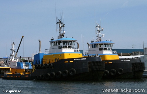
 Gulf Titan
Current Status
Where is the vessel?
Gulf Titan is currently in 27 nm SE of Ketchikan, based on AIS data received about 1h ago.
Latest AIS update:
Current position: 55.01517° N, 131.09660° W (27 nm SE of Ketchikan)
Average speed (last 7 days): Loading…
Average speed (last 30 days): Loading…
Vessel profile: Gulf Titan is a Tug with dimensions 34m x 11m.
This page combines live AIS, route history, probable destination signals, nearby traffic, and port activity for practical vessel monitoring.
The current position of vessel Gulf Titan is 55.01517 lat / -131.09660 lng. Updated: 2026-03-26 19:51:29 UTCNearest reference points:
- Near Ward Cove
- Near Prince Rupert
- Near Watson Island
Currently sailing under the flag of USA ![]()
Details:
Live Vessel Gulf Titan Analytics (details, animations, etc.)
Recent AIS points (UTC):
2026-03-26 13:35:07 UTC · 55.34878, -131.69063 · SOG 6.3 kn · COG 135°2026-03-26 15:22:18 UTC · 55.35182, -131.68968 · SOG 0 kn · COG 300°
2026-03-26 18:15:28 UTC · 55.20640, -131.33475 · SOG 10 kn · COG 116°
2026-03-26 19:51:29 UTC · 55.01517, -131.09660 · SOG 9.6 kn · COG 162°