 vesseltracker.com
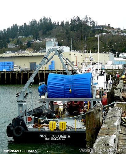
 Nrc Columbia
Current Status
Where is the vessel?
Nrc Columbia is currently in Near Bellingham, based on AIS data received less than 1h ago.
Latest AIS update:
Current position: 48.81814° N, 122.71963° W (Near Bellingham)
Average speed (last 7 days): Loading…
Average speed (last 30 days): Loading…
Vessel profile: Nrc Columbia is a Pollution Control Vessel with dimensions 36m x 9m.
This page combines live AIS, route history, probable destination signals, nearby traffic, and port activity for practical vessel monitoring.
The current position of vessel Nrc Columbia is 48.81814 lat / -122.71963 lng. Updated: 2026-04-20 01:23:57 UTCNearest reference points:
- Near White Rock
- Near Bellingham
- Near ORCAS
Currently sailing under the flag of USA ![]()
Nrc Columbia built in 1992 year
Deadweight:
283 tDetails:
Live Vessel Nrc Columbia Analytics (details, animations, etc.)
Recent AIS points (UTC):
2026-04-19 22:56:57 UTC · 48.81818, -122.71941 · SOG 0 kn · COG 192°2026-04-19 23:44:57 UTC · 48.81818, -122.71945 · SOG 0 kn · COG 191°
2026-04-20 01:23:57 UTC · 48.81814, -122.71963 · SOG 0 kn · COG 196°
2026-04-20 01:23:57 UTC · 48.81814, -122.71963 · SOG 0 kn · COG 196°