 vesseltracker.com
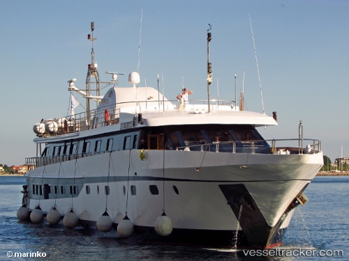
 Harmony G
Current Status
Where is the vessel?
Harmony G is currently in Near PERAMA, based on AIS data received about 1h ago.
Latest AIS update:
Current position: 37.96071° N, 23.57134° E (Near PERAMA)
Average speed (last 7 days): Loading…
Average speed (last 30 days): Loading…
Vessel profile: Harmony G is a Service Ship with dimensions 53m x 53m.
This page combines live AIS, route history, probable destination signals, nearby traffic, and port activity for practical vessel monitoring.
The current position of vessel Harmony G is 37.96071 lat / 23.57134 lng. Updated: 2026-04-19 01:45:20 UTCNearest reference points:
- Near PERAMA
- Near Keratsínion
- Near Drapetzona
Currently sailing under the flag of Greece ![]()
Harmony G built in 2001 year
Deadweight:
79 tDetails:
Live Vessel Harmony G Analytics (details, animations, etc.)
Recent AIS points (UTC):
2026-04-18 19:54:19 UTC · 37.96072, 23.57134 · SOG 0 kn · COG 180°2026-04-18 22:12:20 UTC · 37.96071, 23.57132 · SOG 0 kn · COG 181°
2026-04-18 23:33:20 UTC · 37.96072, 23.57134 · SOG 0 kn · COG 181°
2026-04-19 01:45:20 UTC · 37.96071, 23.57134 · SOG 0 kn · COG 181°