 vesseltracker.com
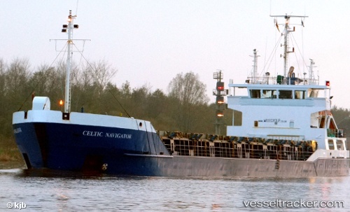
Vessel Tugberk Imamoglu IMO: 9003548, MMSI: 271044604 General Cargo Ship
UTC, 36.92510, 7.81328, course: 304, speed: 0
UTC, 36.92485, 7.81267, course: 356, speed: 0.1
2026-03-25 01:29:19 UTC, 36.92500, 7.81333, course: -1, speed: 0
Live Vessel Tugberk Imamoglu Analytics (details, animations, etc.)
Live AIS position: UTC. Near Annaba), updated 2026-03-25 01:29:19 UTC.Find the position of the vessel Tugberk Imamoglu on the map. The latter are known coordinates and path.
marine traffic ship tracker show on live map
The current position of vessel Tugberk Imamoglu is 36.92500 lat / 7.81333 lng. Updated: 2026-03-25 01:29:19 UTCDetails:
Last coordinates of the vessel:
UTC, 36.92333, 7.81167, course: -1, speed: 0UTC, 36.92510, 7.81328, course: 304, speed: 0
UTC, 36.92485, 7.81267, course: 356, speed: 0.1
2026-03-25 01:29:19 UTC, 36.92500, 7.81333, course: -1, speed: 0