 vesseltracker.com
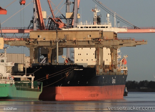
 Aracari Arrow
Current Status
Where is the vessel?
Aracari Arrow is currently in Near Pecém Pt/São Gonçalo do Amarante, based on AIS data received about 22h ago.
Latest AIS update:
Current position: 3.52981° S, 38.79507° W (Near Pecém Pt/São Gonçalo do Amarante)
Average speed (last 7 days): Loading…
Average speed (last 30 days): Loading…
Vessel profile: Aracari Arrow is a Multi Purpose Carrier with dimensions 200m x 198m.
This page combines live AIS, route history, probable destination signals, nearby traffic, and port activity for practical vessel monitoring.
The current position of vessel Aracari Arrow is -3.52981 lat / -38.79507 lng. Updated: 2026-04-10 07:48:44 UTCNearest reference points:
- 28 nm N of Pecém Pt/São Gonçalo do Amarante
- 81 nm N of Acarau
Currently sailing under the flag of Bahamas ![]()
Aracari Arrow built in 1992 year
Deadweight:
46956 tDetails:
Live Vessel Aracari Arrow Analytics (details, animations, etc.)
Recent AIS points (UTC):
2026-04-10 02:03:42 UTC · -3.52978, -38.79508 · SOG 0 kn · COG 140°2026-04-10 03:24:43 UTC · -3.52981, -38.79508 · SOG 0 kn · COG 140°
2026-04-10 06:09:44 UTC · -3.52981, -38.79508 · SOG 0 kn · COG 140°
2026-04-10 07:48:44 UTC · -3.52981, -38.79507 · SOG 0 kn · COG 140°